Local Government Update - July 2025
- Baldwin REALTORS

- Jul 31, 2025
- 7 min read
Fairhope Planning Commission Meeting – July 7, 2025
Two-Lot Re-Subdivision Approved for Future Industrial Development
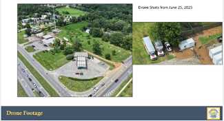
The Fairhope Planning Commission approved the re-subdivision of 17 acres zoned M-1(Light Industrial) into two lots. The property is located at 8100 McGowan Drive, south of the Fairhope Airport and off Hwy. 98. The re-subdivision was sought to carve out an area on the southern portion for potential future development. No specific plans were disclosed. Any developmental use would have to be compatible with the M-1 zoning district.
Annexation and Zoning Recommended for Commercial Parcel
The Fairhope Planning Commission recommended the approval of zoning requests which were concurrent with an annexation petition. The 4.65-acre and 2.23-acre properties are located at the southwest corner of the intersection of Hwy. 181 and Hwy. 104. Currently the property is zoned B-4 by Baldwin County. If approved by the City Council the parcels will be incorporated into the city limits and be classified under city zoning dist. B-2, the most compatible city equivalent district. Two adjacent businesses are currently operating on the site including The Hub convenience store gas station and Sweat Tire with an ancillary pine straw business. Under city guidelines a 20-foot landscape buffer will be installed between abutting residential properties to the south.
Daphne City Council Meeting – July 7, 2025
Daphne to Collect Impact Fees Starting in 2027
The Daphne City Council adopted an impact fee ordinance establishing impact fees on new developments to help fund infrastructure projects to keep up with continued growth. The one-time charges on new residential and non-residential buildings will help fund parks, recreation, transportation improvements, fire services, and police. The fees will be determined using the lesser of either a set amount based on the type and size of the development or 1% of the total construction and land cost. The ordinance will have a delayed effective date of August 1, 2027.
Spanish Fort City Council Meeting – July 8, 2025
Spanish Fort Secures Easement for Infrastructure
The Spanish Fort City Council announced the acquisition of a critical 80-foot easement that will unlock long-term recreational and connectivity opportunities for the community. The easement, donated by owners of Eastern Shore Lanes, runs across the Eastern Shore Lanes property and connects to Eastern Shore Blvd. This will serve as an access point for future athletic fields. The city has plans to develop a new regional athletic complex which will include ten baseball fields with turf for multi-sports use. The 80’ right-of-way easement will allow for additional infrastructure to provide greater connectivity and ease traffic congestion in the area by providing an alternate route.

Baldwin County Planning Commission Meeting – July 10, 2025
RV Storage Approved for County Rd. 55
An RV Storage development has been approved on a 6-acre un-zoned parcel located at the intersection of Underwood Rd. and County Rd. 55. A total of seven RV storage buildings is planned for the site.
Fireworks Stand Planned for Lilian Area
The Baldwin County Planning Commission approved the site plan for a fireworks stand to be located at the intersection of County Road 99 and Hwy. 98 in the Lillian area. The .84-acre site is zoned B-2. The site plan approval will allow for a 32’ x 70’ fireworks stand with conditions that the layout be revised with connectivity to adjacent parcels to the east to improve traffic circulation and provide overflow parking.
Mini-Storage Planned Near Orange Beach
The Baldwin County Planning Commission approved the site plan for Binger Storage. The 1.4-acre property is located south and west of Roscoe Road in the Orange Beach area. There are four buildings planned for B-3 zoned property which will house mini-storage.
Spanish Fort Planning Commission Meeting – July 14, 2025
Automotive and Truck Service Station Planned for Spanish Fort
The Spanish Fort Planning Commission approved the land use application for an automobile and truck service station to be located on a currently vacant lot east of MAPCO station along Hwy. 31. The 9.5-acre parcel is zoned B-3.
Orange Beach City Council Meeting – July 15, 2025
Signage Amendment Denied for The Oasis
The Orange Beach City Council voted to deny a request from The Oasis at Orange Beach located at 23450 Perdido Beach Blvd. The Oasis was requesting an amendment to the signage regulations to allow an 80-square-foot digital sign per side (160 square feet total), which exceeds the residential limit but is less that the commercial imit. The council voted to deny the request and during discussion cited a reluctance to set a precedent for other condos.

Keel RV Storage Addition Approved in Orange Beach
The Orange Beach City Council gave final approval for a conditional use permit for Keel RV Storage. The approval will allow for the addition of three mini warehouse buildings to be added to the site located at 27103 Canal Rd. Each building will contain 9,000 square feet of space. The 3.8-acre site will use the existing gravel road onto Canal Road for ingress and egress. The facades facing Canal Road will be board and batten siding, with the remaining sides metal.

Baldwin County Commission Meeting – July 16, 2025
Golf Course Development Approved South of Fairhope
The Baldwin County Commission approved a Planned Residential Development (PRD) and the partial rezoning for the proposed Point Clear Golf Club, a high-end residential and recreational community. The property is located west of County Road 3 and north of County Road 24, south of Fairhope. The development spans 310 acres west of County Road 3—part of a larger 548-acre master plan, which also includes 237 acres to the east. While the site is currently zoned RA (Rural Agricultural), the applicant requested to rezone 90.87 acres to RSF-1 (Single Family Residential) to accommodate denser, yet upscale, housing options. The project will feature 126 housing units, significantly under the allowable density of 200 units. The project amenities will include a wellness center, pools, dining venues, walking trails, and a championship 18-hole golf course.


Elsanor Re-Zoning Approved
The Baldwin County Commission approved the rezoning of 40 acres located in the Elsanor community north of US Highway 90 and south of Price Grubs Road. The property’s zoning will change from RA (Rural Agricultural) to RSF-1 (Single Family Residential) to accommodate future residential use. Any future residential development request will undergo a separate application and public hearing process. Developers stated that current plans contemplate a 9-lot subdivision.
Foley Planning Commission Meeting – July 16, 2025
BJ’s Wholesale Club Planned for Foley
The Foley Planning Commission approved the commercial site plan for BJs Wholesale Club. The 14-acre site is located east of S. McKenzie St. and north of S. Juniper St. Extension. The 106,000 square foot building will house the discount club which includes groceries, household goods, tires, automotive services, electronics, etc. Construction is expected to begin in September.

Gulf Shores Planning Commission Meeting – July 22, 2025
The Retreat at Bon Secour Village PUD Amendment Approved
The Gulf Shores Planning Commission recommended approval of a Planned Unit Development (PUD) Amendment requested by The Retreat at Bon Secour Village Homeowners Association (HOA) on behalf of the owners of lots 20 through 25. The amendment brings these lots into the existing PUD with an underlying zoning designation of R-1-4, which permits only single-family residential use. Located along the Intracoastal Waterway, lots 20–25 were previously outside the boundaries of the PUD. The HOA’s request aims to eliminate the potential for duplex construction on these parcels, thereby ensuring that only single-family homes—consistent with the existing character and development standards of Bon Secour Village—may be built. Under the amendment, these lots will be governed by the current covenants and restrictions of The Retreat at Bon Secour Village and will be granted access to community amenities, including the cabana and pool facilities.

County Road 6 Re-Zoning Sought
The Gulf Shores Planning Commission voted to recommend the re-zoning of five parcels near the intersection of County Road 6 and Oyster Bay Road. The properties—some vacant and others with residential dwellings—are currently zoned R-4 (multi-family) and R-1-4 (single-family). The proposed zoning change to BG (General Business) aims to support commercial uses in line with the city's updated land use plan, which recently expanded the commercial activity node around this intersection. Immediate plans include using the two northern lots for overflow parking for a nearby restaurant project, Shipwreck Kelly’s, while no specific development is planned for the remaining lots.
Parking Changes Recommended for Waterway Village Overlay Dist.
The Gulf Shores Planning Commission recommended approval of a zoning text amendment designed to enhance parking flexibility in the Waterway Village Overlay District. The changes increase the allowable distance for parking credits to be considered between the proposed use and a parking area from 750 feet to 1,320 feet (a quarter mile). Additionally, on-street parking within 200 ft. may be considered, and up to 100% of the required parking may be through the purchase of public parking credits. To qualify as on-street parking, the lots must be paved, publicly accessible, and not in conflict with fire safety. The update is intended to support denser, walkable development in the area, which includes many small lots constrained by current parking mandates. Several citizens raised concerns over potential overdevelopment and insufficient parking infrastructure, but staff emphasized the upcoming comprehensive parking study by Kimley-Horn will address future needs. The proposed amendments do not change short-term rental policies, but staff acknowledged further zoning updates may follow once the parking study concludes in several months.
Gulf Shores Seek to Change Roadway Construction Standards
The Planning Commission recommended approval of an update to the city’s subdivision regulations regarding roadway construction standards. The amendment increases the required asphalt thickness for new subdivision streets from two inches to 3.25 inches, spread over two layers, and mandates the use of B-base material for improved durability. Minimum concrete strength for curbs and sidewalks is raised from 3,000 to 4,000 PSI, aligning with Alabama Department of Transportation (ALDOT) standards. Additionally, the city will now require thermoplastic striping instead of standard paint due to its superior durability and visibility. The updates are intended to extend the service life of new roads to 20 years, shift long-term maintenance costs from the city to developers, and ensure higher construction quality from the outset. These standards will apply to all new subdivisions whose roads are intended for city acceptance.


Comments